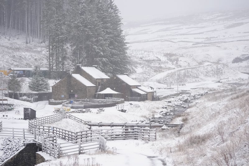
We’ve had some pretty atrocious weather in the UK recently. But more snow? And in March? Say it ain’t so. Pretty much the whole of the UK was forecast to be under some kind of weather warning this weekend, with the Met Office issuing yellow alerts for heavy rain and storm winds.
![[CRATHIE,SCOTLAND - JANUARY 10: Two skiers make their way along the B976 following the coldest night of winter so far, with an overnight low of of -14.5C recorded at Altnaharra on January 10, 2025 in Crathie, Scotland. The Met Office has issued weather warnings as a cold snap sweeps across the UK, bringing freezing temperatures and bouts of ice, snow, and rain. (Photo by Jeff J Mitchell/Getty Images)]](https://metro.co.uk/wp-content/uploads/2025/02/SEI_235550623-93e8.jpg?quality=90&strip=all&w=646)
Ryanair issued a warning to its passengers over potential disruption due to high winds, while National Rail said Sunday train journeys could be affected. Meanwhile, some other forecasters are projecting a return to icier conditions in the coming weeks with temperatures plunging below zero again and snow blanketing huge swathes of the home nations.
![[A Metro graphic weather warning map showing where Met Office rain and wind warnings are in place on Sunday in the UK.]](https://metro.co.uk/wp-content/uploads/2025/02/SEI_240825139-38a7.jpg?quality=90&strip=all&w=646)
The Met Office had initially predicted snow in its long-range forecast from February 26 through to March 7. Flurries of the white stuff could well be on the horizon but don’t be reaching for your grit and grippers just yet. Greg Dewhurst, senior operational meteorologist with the Met Office, told Metro: ‘I would say some snow may be possible at times over the hills in the north in particular, which is not unusual for the time of year.’.
![[Two women covering their faces from heavy rain in the UK.]](https://metro.co.uk/wp-content/uploads/2025/02/SEI_240848341-93d4.jpg?quality=90&strip=all&w=646)
According to the forecaster’s longer-range prediction, ‘changeable weather is expected across the UK during this period with Atlantic weather systems spreading in from the west at times’. It says: ‘These systems will bring periods of wet and windy weather, with a risk of heavy rain and gales at times.
![[A map showing where Environment Agency flood warnings are in place in the UK as rain and wind is forecast.]](https://metro.co.uk/wp-content/uploads/2025/02/SEI_240845098-b208.jpg?quality=90&strip=all&w=646)
‘The heaviest rainfall and strongest winds are most likely to affect western and northwestern regions of the UK, with rainfall totals typically lower and winds lighter in the southeast.’. But it adds that ‘between weather systems, some drier and brighter interludes are likely to develop with lighter winds, spells of sunshine and perhaps a few showers’.
To get the latest news from the capital visit Metro's London news hub. ‘Temperatures are likely to be above average overall, although some short-lived colder spells are possible at times, particularly in the north of the UK.’. The Met Office issued yellow weather warnings for torrential downpours and strong winds making a landing on Sunday.
Most of England and all of Wales, Scotland and Northern Ireland will be battered by rough weather, although London and the South East of England will be spared the worst of the wet weather front. Despite the gloomy forecast, warm temperatures are set to hover near 10C across the UK.
Heavy rain is expected to cause flooding and wreak havoc on train and bus travel. Two red flood warnings are also active in Wiltshire due to high water levels in the Salisbury Plain area. The forecaster issued five fresh alerts covering most of the UK and Northern Ireland.
Gusts of 50-60mph are expected through Sunday morning and afternoon along with rain in parts of England, Wales and Scotland. Spray and flooding could make conditions on roads difficult while homes could be cut off. Flood water could cause ‘a danger to life’ in places where it is fast flowing, the Met Office warned.
Winds could blow at gusts of up to 70mph in exposed areas along the Irish Sea coastlines, Scottish Islands and other high-ground areas further inland, Met Office warned. The wind warning is in place from 6am until 6pm on Sunday in North West of England, North East, South West, West Midlands, East Midlands, Yorkshire and Humber, in Wales and in all of Scotland, including Orkney and Highland islands.
Northern Ireland’s wind warning is active from 3am until 3pm. The rain warnings are more scattered around, but where it is forecast, up to 50mm could land in exposed hills while 20-30mm is common. Heavy downpour is expected in Cornwall, Devon and Plymouth in the South West of England and in southern and southwestern parts of Wales between 9am and 9pm, and in Cumbria, South West Scotland and Lothian Borders and Strathclyde from 7am until 3pm.
Get in touch with our news team by emailing us at webnews@metro.co.uk. For more stories like this, check our news page. Arrow MORE: Homeless man starved to death while dangling from skylight for six days. Arrow MORE: Inside London’s newest bar with 30 screens showing iconic horror movies.
Arrow MORE: Full list of 9 Lidl supermarkets opening this month creating hundreds of jobs. Stay on top of the headlines with daily email updates. This site is protected by reCAPTCHA and the Google Privacy Policy and Terms of Service apply. Your information will be used in line with our Privacy Policy.