The 'arctic express' is set to blast the Eastern US with another round of frigid air this week, sending temperatures plummeting 10 to 20 degrees F below average. The jetstream will carry a blast of cold air through the Midwest, Northeast and Southeast starting January 15, with some states experiencing temperatures that feel as low as -30F.
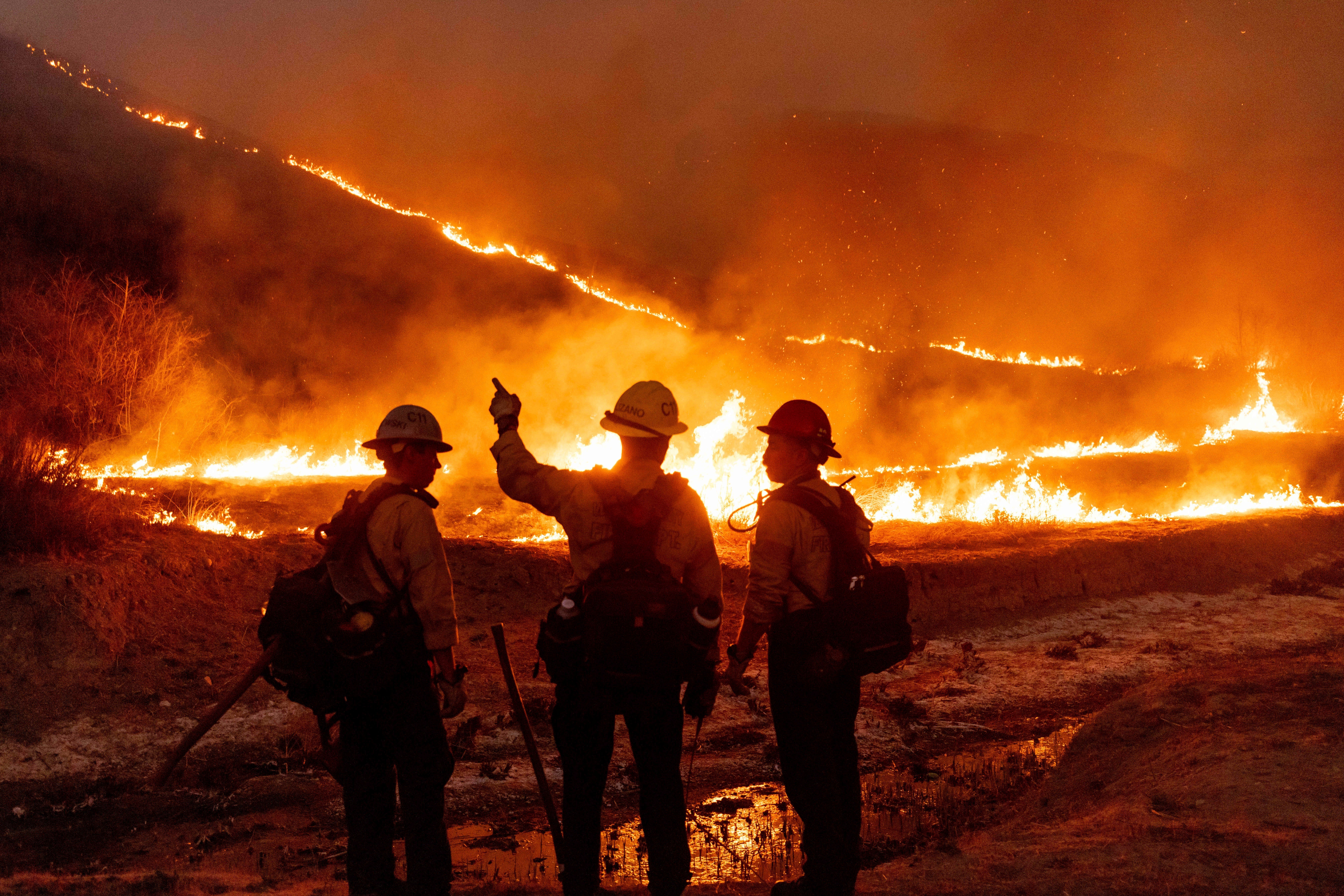
![[Hot, dry hurricane-force gusts should return to Southern California Monday afternoon and persist through Wednesday, reaching speeds of 60 to 100 mph and reigniting fire risk]](https://i.dailymail.co.uk/1s/2025/01/13/14/94040341-14278637-image-a-5_1736780389935.jpg)
However, heavy lake-effect snow — which occurs when cold air moves over the relatively warm surface of a lake — could fall downwind of the Great Lakes, and some snow squalls may hit midwestern and northeastern states. While the East braces for freezing temperatures, the West Coast is poised for a resurgence of the Santa Ana winds that have triggered deadly wildfires in Southern California.
![[Multiple blasts of Arctic air have been chilling the eastern US this month, with more on the way]](https://i.dailymail.co.uk/1s/2025/01/13/14/94038459-14278637-image-a-2_1736780319633.jpg)
The winds died down over the weekend, granting firefighters much-needed time to gain some control over three active blazes still scorching the Los Angeles metro area. But the Palisades and Eaton fires, the two largest and deadliest, are still burning at just 13 and 27 percent containment, respectively.
![[By Tuesday morning, at-or-below-freezing temperatures will stretch as far south as Texas, Mississippi and Georgia, increasing strain on heating budgets and the risk of frozen pipes]](https://i.dailymail.co.uk/1s/2025/01/13/16/94038453-14278637-By_Tuesday_morning_at_or_below_freezing_temperatures_will_stretc-a-108_1736785861472.jpg)
The hot, dry hurricane-force gusts should return Monday afternoon and persist through Wednesday, reaching speeds of 60 to 100 mph. The National Weather Service (NWS) issued new fire weather warnings Sunday, warning of a 'particularly dangerous situation' for Los Angeles through midweek.
![[It's already been a very cold start to 2025 in Eastern states, and meteorologists warn that the frigid temperatures are here to stay through the end of the month]](https://i.dailymail.co.uk/1s/2025/01/13/15/94040967-14278637-It_s_already_been_a_very_cold_start_to_2025_in_Eastern_states_an-a-1_1736781754907.jpg)
Meanwhile, the eastern US is bracing for another blast of Arctic air that will send temperatures plummeting 10 to 20 degrees F below average. Hot, dry hurricane-force gusts should return to Southern California Monday afternoon and persist through Wednesday, reaching speeds of 60 to 100 mph and reigniting fire risk.
![[The West is battling a very different surge of severe weather, as Los Angeles grapples with one of the largest and deadliest wildfire catastrophes in California's history]](https://i.dailymail.co.uk/1s/2025/01/13/15/93879405-14278637-image-a-7_1736780621429.jpg)


