Storm quickly weakened after making landfall east of Port Hedland with strongest parts hitting remote areas. Properties have been damaged and large trees uprooted by an ex-tropical cyclone still wreaking havoc in Western Australia, with record rainfall triggering significant flooding. Tropical Cyclone Zelia made landfall in the north-west of Western Australia on Friday and was quickly weakened as it crossed the coast east of Port Hedland.
![[Satellite view of Zelia as it hit the Western Australia coast.]](https://i.guim.co.uk/img/media/b5457904dd7583be1db4900f846950344b2ebb35/0_172_3000_1800/master/3000.jpg?width=445&dpr=1&s=none&crop=none)
Surrounding areas suffered property damage when winds of up to 120km/h struck, but the strongest parts of the system – which was at category four when it made landfall – hit remote areas, according to Angus Hines, a senior meteorologist at the Bureau of Meteorology. “In many places, especially around Port Hedland, it is fortunate that the winds were not even stronger which certainly could have been the case if the tropical cyclone had taken a different path,” he said.
![[Flooded streets in Port Hedland]](https://i.guim.co.uk/img/media/b0bb6b5ba6d09a136af04ccd5c409a5bc1f416fc/0_122_8192_4918/master/8192.jpg?width=445&dpr=1&s=none&crop=none)
A record 500mm of rain fell in just three days in parts of the Pilbara, with 278mm recorded at Upper North Pole in just 18 hours. The small town of Telfer, about 400km south of Broome, copped 93mm in one hour. Sign up for Guardian Australia’s breaking news email. “This is exceptionally rare for that location and that part of the world,” Hines said. “The rain has caused significant flooding and widespread road closures across the Pilbara region”.
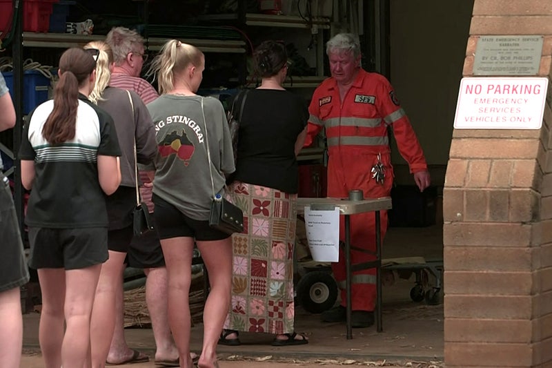
Port Hedland’s SES deputy manager, Barry Harrison, told ABC News Breakfast that the region “really dodged a bullet” when the cyclone moved east, taking destructive winds away from the regional centre, despite earlier fears it would take a direct hit. “[There has been] literally hundreds and hundreds of trees that have been uprooted [and we’re] currently sitting on about 30 jobs of requests for assistance in that area,” he said.
“We are very, very lucky. [The ex-tropical cyclone] is still dancing around out there and dropping a lot of rain as she goes.”. Port Hedland is one of the world’s largest iron ore export points, with any lengthy cyclone-enforced port closure potentially disrupting global supply. Ships and trains were cleared from ports in the area in preparation for Zelia but mining groups said it was too early to tell what impact it would have on supply as the north-west recovered.
A severe weather warning remains for the parts of Pilbara, Gascoyne, North Interior and South Interior districts, with flood watches and flood warnings across the region. “Rainfall totals of up to 120mm are expected in the coming 24 hours, which is a lot for this typically quite dry region,” Hines said. “We may still see river rises in the coming 24 hours.”. The WA Department of Fire and Emergency Services said damage assessments began at first light, with locals urged to remain indoors amid flood warnings and road closures.
“The cyclone has passed however there remains a possible threat to lives and homes,” an alert on Saturday morning said. More than 10,000 sandbags have been handed out in the Pilbara to help people prepare their properties for flooding, the DFES said. Sarah Scully, a senior BoM meteorologist, told the Today Show the severe weather warning would continue over the weekend. “The flooding impacts are expected to continue for several days,” she said. “However, the heavier rainfall will just slowly be dragged southwards as we move into early next week.”.
Zelia approached the Western Australian coast with winds of up to 290km/h, initially sparking fears in Port Hedland of Cyclone Ilsa’s deadly impact in 2023 when eight people died. The Australian Defence Force will assist with the recovery after the wild weather closed roads, schools, shops and ports, with about 200 people fleeing to evacuation centres. Zelia is forecast to move south further into the Pilbara and parts of the Gascoyne on Saturday as it loses intensity but is still expected to bring heavy rainfall.