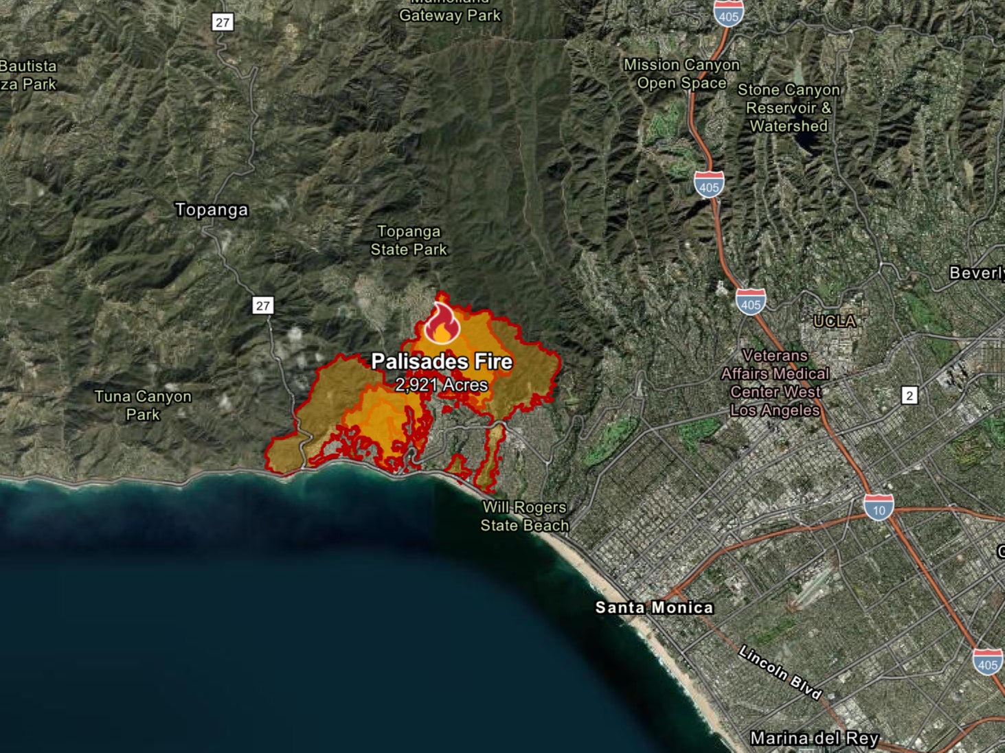
Horror 3D map shows LA consumed by wildfires as city faces being plunged into darkness before new ‘Devil’s Wind’ threat
Share:
A HAUNTING animated map reveals the sheer scale of an LA wildfire that has burned across more than 23,000 acres. Palisades Fire has been raging for a week - with residents braced for further destruction as severe winds threaten to fan flames. A chilling 3D map shows how quickly the blaze - the largest of the fires and one of the most destructive in California's history - decimated the area.
![[Animated map showing the Palisades Wildfire's growth over several days.]](https://www.the-sun.com/wp-content/uploads/sites/6/2025/01/x-animated-map-shows-timeline-963648152.jpg?strip=all&w=960)
Homes have been reduced to smoldering ruins, while an apocalyptic landscape is all that remains in some neighborhoods. The Palisades Fire erupted on January 7 - and by that evening had spread across almost 3,000 acres. It then roared across more than 17,000 acres by the following night.
![[Animated map showing the Palisades Wildfire growth near Malibu.]](https://www.the-sun.com/wp-content/uploads/sites/6/2025/01/x-animated-map-shows-timeline-963648156.jpg?strip=all&w=960)
By Saturday morning, the inferno had consumed some 22,660 acres, and continues to spread. The blaze remained at 14 per cent contained as of Monday evening and has claimed at least eight victims. At least 24 people have died in total in the fire, and 23 others are missing in the Palisades and Eaton zones.
![[Fire-ravaged homes near the Pacific Ocean.]](https://www.the-sun.com/wp-content/uploads/sites/6/2025/01/pacific-ocean-seen-distance-beyond-963556140_848d8f.jpg?strip=all&w=960)
And now residents in LA face having their power cut today in a desperate attempt to prevent more wildfires from ravaging the city. Strong Santa Ana winds - branded the Devil Winds - are expected to arrive early Tuesday morning, bringing an increased threat of more blazes.
![[Helicopter dropping water on wildfire.]](https://www.the-sun.com/wp-content/uploads/sites/6/2025/01/firefighting-planes-helicopters-drop-water-962956507.jpg?strip=all&w=960)
The Los Angeles Department of Water and Power asked users in high-risk fire areas to prepare for outages lasting over 48 hours. The utilities authority said on Monday: “Los Angeles is in active fire response and local fire authorities may ask LADWP to de-energise power lines as a preventative measure, to help prevent wildfires and protect communities.”.
![[American flag flies above a wildfire-damaged area.]](https://www.the-sun.com/wp-content/uploads/sites/6/2025/01/american-flag-waves-section-mandeville-963223242_8a9562.jpg?strip=all&w=960)


