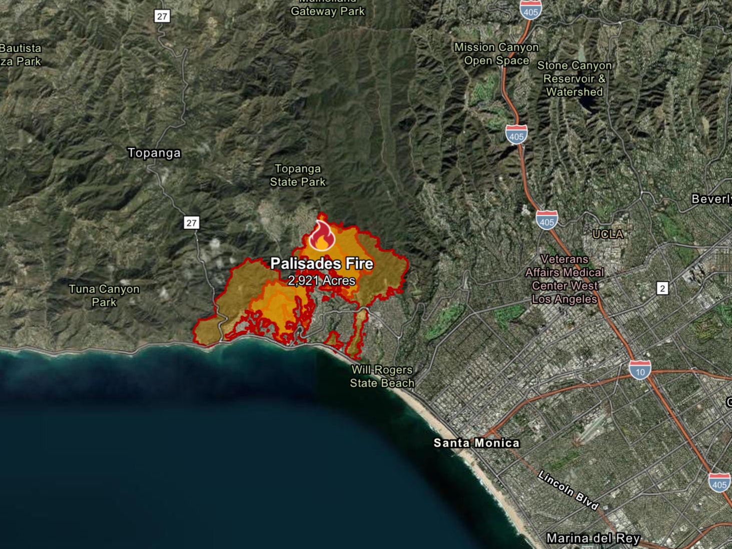
See the LA wildfires from SPACE: Satellite images reveal just how quickly blazes exploded over the last two days thanks to powerful Santa Ana winds
Share:
As the Los Angeles fires continue to rage, images from space now reveal just how quickly the blazes exploded. On the morning of January 7, severe droughts and winds of up to 100 miles per hour whipped up wildfires in the affluent LA suburb of Palisades.
![[January 7: By the time NASA captured an image of the blaze later in the afternoon of January 7, the Palisades fire had spread exponentially and was producing a vast column of smoke]](https://i.dailymail.co.uk/1s/2025/01/09/10/93903109-14266025-image-a-20_1736417343078.jpg)
Since then, the infernos have killed at least five people, destroyed thousands of homes, and forced over 130,000 residents to evacuate. Captured by a network of orbiting satellites, shocking photos show how the blazes spread to cover more than 27,000 acres in just three days.
![[January 7: With extremely dry conditions and strong winds, the Palisades fire spread quickly inland and to the East into the populated areas of the Palisades neighbourhood]](https://i.dailymail.co.uk/1s/2025/01/09/10/93903115-14266025-image-a-23_1736417388638.jpg)
As the blaze erupted on Tuesday, the European Space Agency’s Sentinel-2 satellite spotted the first plumes of smoke stretching out over the Pacific Ocean. In images taken only hours later, NASA’s Aqua satellite showed how the blaze had already spread into the winding streets of the Pacific Palisades neighbourhood.
![[January 7, 14:54 local time: This satellite image captures the intense glow of the wildfire as it spread throughout the suburb, destroying more than 11,000 hectares by the afternoon of January 8]](https://i.dailymail.co.uk/1s/2025/01/09/10/93903091-14266025-image-a-24_1736417403989.jpg)
And, in timelapse footage captured by the Cooperative Institute for Research in the Atmosphere (CIRA) you can see how powerful Santa Ana winds drove the infernos to spread rapidly through the city. In a post on X, CIRA said: 'The Palisades Fire and Eaton Fire continue their rapid growth near Los Angeles as both have scorched over 10,000 acres.'.
![[January 8: In the evening, blazes erupted in the northern area of Easton. The blaze has now killed five people and destroyed more than 1,000 homes]](https://i.dailymail.co.uk/1s/2025/01/09/10/93903033-14266025-image-a-16_1736417136593.jpg)
January 7, 10:36 local time: This first image of the Palisades wildfire shows how the blaze began as a forest fire just west of Santa Monica. January 7: By the time NASA captured an image of the blaze later in the afternoon of January 7, the Palisades fire had spread exponentially and was producing a vast column of smoke.
![[January 8: Firefighters battle the Eaton fire as it spreads across more than 10,000 hectares of northern Los Angeles]](https://i.dailymail.co.uk/1s/2025/01/09/10/93903027-14266025-image-a-17_1736417142483.jpg)


